Seychelles signs agreement with UK for aid in updating bathymetric charts
 Send to Kindle
Seychelles has signed an agreement with the United Kingdom's Hydrography Organisation to update its bathymetric charts.
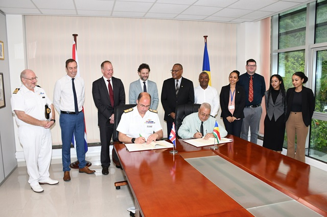
The new memorandum of understanding (MOU), which will further strengthen collaboration in hydrography, was signed on Friday by Patrick Andre, the principal secretary for Transport and UK's national hydrographer, Rear Admiral Angus Essenhigh.
After the signing, the Minister for Transport, Antony Derjacques, said this MOU "follows the decision by the Cabinet of Ministers in March to revive Seychelles' membership to the International Hydrography Organisation. The last update to the Seychelles' official hydrographic map was done back in 1976, so an update is highly necessary. The hydrographic layout is something that is constantly changing, so it needs to be documented."
A bathymetric chart depicts the submerged topography and physiographic features of ocean and sea bottoms and its primary purpose is to provide detailed depth contours of ocean topography as well as provide the size, shape and distribution of underwater features.
According to the Ministry of Transport, a phase of this project began in January in the form of a survey and was done in collaboration with the UK government. Through a $3 million grant, the UK government facilitated comprehensive new surveys of Seychelles' waters, which was completed in the first quarter of this year.
The deputy chief executive of the Seychelles Ports Authority, Egbert Moustache, said that the work being done to update the hydrographic charts of Seychelles will be very useful.
"This is information that is needed for the port extension project. The old charts do not contain all the changes that have happened over the years. The channel will need to be dredged to allow for bigger boats for the extension but we won't be able to do that if we don't know what is there," said Moustache.
Derjaqcues clarified that the size of the Seychelles Exclusive Economic Zone (EEZ) of 1.4 million square kilometres means that not everything can be covered in the survey at the moment. Seychelles has asked that essential areas be completed first, such as around Mahe, Praslin, and La Digue, the three most populated islands, as well as areas with heavy traffic shipping trade lanes, especially around the Aldabra Atoll.
The MOU also establishes a framework to enhance the existing commercial arrangements related to the sale of new charts. It can potentially lead to new income for Seychelles from the sale of bathymetric charts and establish a path for future revenue generation.
"With this update in charts, Seychelles is expected to receive 12.5 percent of royalties on the sale of the charts that will be sold. We've also been made aware that there is a sum of money that has accumulated over the years from the sale of the previous chart that will be given to the Seychelles," said Derjaqcues.
He added that the money will be put towards establishing a hydrography unit and eventually a hydrography institute for Seychelles in the future.


